About Bloor Homes
Bloor Homes is a family-owned private housebuilder with a reputation for quality, consistently achieving the highest five-star rating for customer satisfaction in the annual National Housebuilders Federation National New Homes Customer Satisfaction Survey. Over 97% of our customers would recommend us to family and friends.
Find out more at: https://bloorhomes.com/
The site
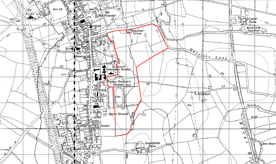
The site for the proposed development extends to approximately 19.55 hectares (ha). It is located on the east side of Coleshill. Maxstoke Lane forms the northern boundary of the site, while the western boundary is formed of existing residential development in Coleshill, including the existing care facilities operated by Father Hudson’s Caritas.
Part of the site is occupied by a number of dilapidated storage sheds and has been used by previous tenants to dispose of various items. The remainder of the site is agricultural land and grassland. There is a Public Right of Way which bisects the site east-west. This will be retained and enhanced as part of any development proposals.
Sustainably located on the settlement edge, the site provides excellent access to a range of local services within a short walk, including the local primary and secondary schools, shops, pubs, restaurants and local healthcare provision. There are also public transport connections within easy access of the site.
The site currently located within the Green Belt. This is being considered in the design of the development, with extensive landscaped parkland proposed.
Coleshill Conservation Area is located to the west of the site, and the proposed development will be designed to take this into account.
There are no technical constraints to sustainable development at the site.
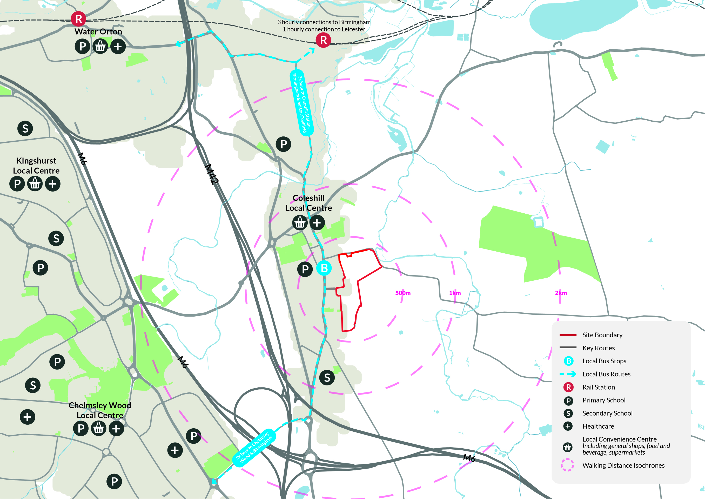
The site is sustainably located on the eastern edge of Coleshill, within a short walk of a range of local services and public transport connections - click to enlarge
Planning policy context
Increased housing targets and Local Plan Review
To address the national housing crisis, the Government has set a target to deliver 1.5 million new homes by 2029. These homes should be delivered in sustainable locations. In December 2024 the Government published a revised National Planning Policy Framework (NPPF) which set increased housing targets for local authorities across England, including North Warwickshire.
The current Development Plan for North Warwickshire has fallen out of date and so the Council is preparing a new Local Plan for the area. Regulation 18 consultation on a review of the Local Plan is currently underway, however it is anticipated to be some time before a new Local Plan is adopted. The site is being promoted for inclusion in the Local Plan review and as such was put forward to the council through their call for sites in 2024. While the site is being promoted through this new Plan, planning applications need to be considered against the current Development Plan as well as national planning policy.
Five-year housing land supply
The NPPF requires Local Planning Authorities to identify sufficient land to meet their housing requirement. At all times they should be able to demonstrate a 5-year supply of deliverable housing land. If a supply of 5 years cannot be demonstrated, a presumption in favour of sustainable development applies. North Warwickshire can currently demonstrate housing land supply of just 2.2 years.
Grey Belt
A new Grey Belt policy was introduced in the NPPF. This allows development in some areas of Green Belt, provided certain criteria are met. Grey Belt includes land that ‘does not strongly contribute’ to green belt purposes which are set out in the NPPF. A Green Belt Assessment has been and it is considered that the site represents Grey Belt under the criteria of the National Planning Policy Framework and Planning Policy Guidance.
Sustainable development
Coleshill is a market town in North Warwickshire Borough. It is identified as a sustainable Category 1 settlement within the North Warwickshire Local Plan. It has a wide range of facilities alongside an efficient and well-connected public transport network, providing linkages between the town and Birmingham, Cambridge and Leicester. These factors, alongside the Borough’s housing supply position, make Coleshill a suitable location for development that will positively contribute to North Warwickshire’s housing land supply.
In light of the site’s sustainable location and the council’s current shortfall in housing land supply, progressing an outline planning application alongside the ongoing process of preparing an updated Local Plan for North Warwickshire will ensure housing delivery at an early stage in the plan period, contributing to addressing the delivery shortfall.
The NPPF has introduced increased housing targets for North Warwickshire, as well as a new Grey Belt policy.
An outline planning application establishes the broad principles of development, such as access arrangements, illustrative concept layout, number of homes and general extent of development.
If outline planning consent is granted, a detailed planning application called a “reserved matters” planning application would be prepared. This would include more detail such as architecture, materials, detailed layout and landscaping, and would be subject to further consultation with the local community before being submitted for determination. Both outline and reserved matters planning applications are subject to Statutory Consultation carried out by the Local Planning Authority (North Warwickshire Borough Council).
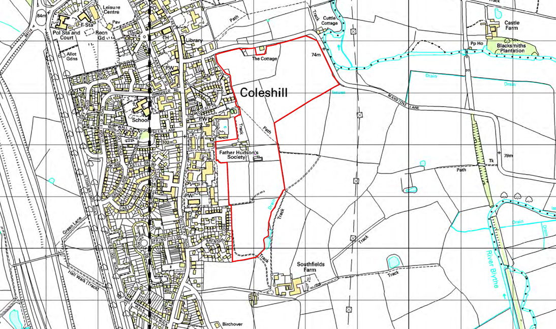
Site constraints and opportunities
How local features and landscape have shaped the proposed illustrative layout of the new neighbourhood.
In preparing the concept layout for the site, the technical team appointed by Bloor Homes first of all considered the landscape, drainage features, topography and local context of the site. The following plan shows some of the features and constraints that have informed the emerging outline proposals. Key features include a public right of way running centrally through the site, existing residential development to the west of the site, Coleshill Conservation Area, the downhill slope of the site to the east, and existing foul and surface water sewers.
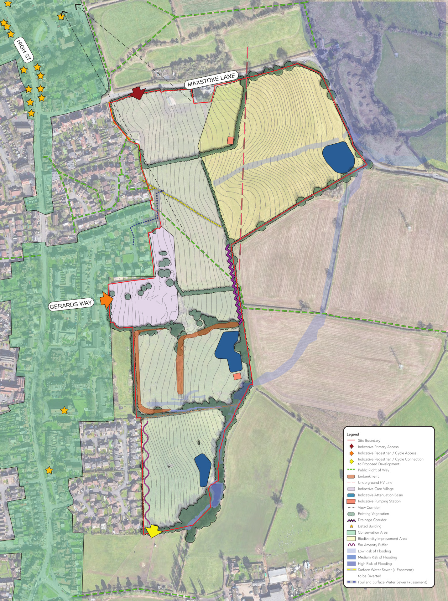
This plan shows analysis of some of the site features that have influenced the illustrative masterplan for the new neighbourhood - click to enlarge
The emerging proposals
To help address a shortfall in local housing delivery, family-owned, five-star rated housebuilder, Bloor Homes, is preparing outline proposals for a sensitively designed residential development set within extensive new public parkland at the site. The development will also provide a new care village operated by Coleshill-based charity, Father Hudson’s Caritas.
The emerging outline proposals include:
- Up to 240 high-quality homes in a range of styles and tenures.
- A significant proportion of the new homes will be provided as affordable housing in a mix likely to include homes for social rent and shared-ownership homes.
- A housing mix which could include accessible homes such as bungalows.
- A new care village owned and operated by local charity, Father Hudson’s Caritas.
- The majority of the site area retained as extensive areas of new landscaped public open space offering a range of outdoor recreational opportunities.
- Open space proposals include a new country park for the wider Coleshill community to enjoy and connect with nature.
- A design approach respecting the wider context of Coleshill and the neighbouring conservation area.
- A package of infrastructure investment to support and expand local services as required through consultation with statutory organisations such as the local NHS, education and highways authorities.
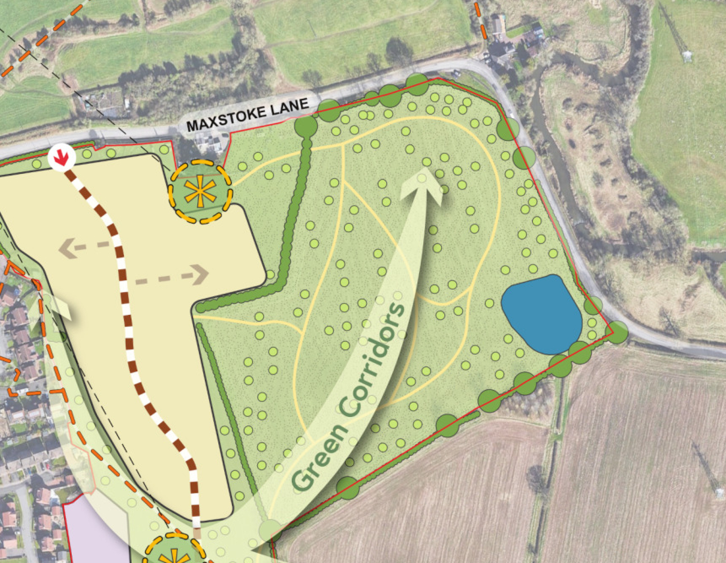
Illustrative concept masterplan
The image opposite shows an illustrative masterplan of the proposed new neighbourhood. You can view the masterplan in more detail on our interactive map by clicking on the image or by following this link.
The illustrative masterplan can accommodate up to 240 homes and a care village, with the net developable area comprising less than 40% of the overall site area. Around 11.85 hectares of green infrastructure are proposed for the remaining 60% of the site. The masterplan has been designed to respect the landscape setting of the site, and to provide a large area of country park for the wider community to enjoy.
A network of public walking and cycling routes will be created throughout the site, providing access to the extensive public open spaces, and there are opportunities to link this network to the existing public rights of way network.
A care village is proposed to be provided centrally within the new neighbourhood, adjacent to existing care facilities operated by local charity, Father Hudson’s Caritas.

Illustrative concept masterplan of the proposed development. Click to open interactive masterplan map.
New homes
House types
The planning application is an outline planning application. This type of planning application sets out the broad principles of development, such as maximum number of homes, an illustrative layout and site access arrangements. Should outline planning permission be received, finer details such as specific house types, detailed layout, architecture etc would be subject to a subsequent further planning application (called a reserved matters planning application). This would involve further consultation with the community.
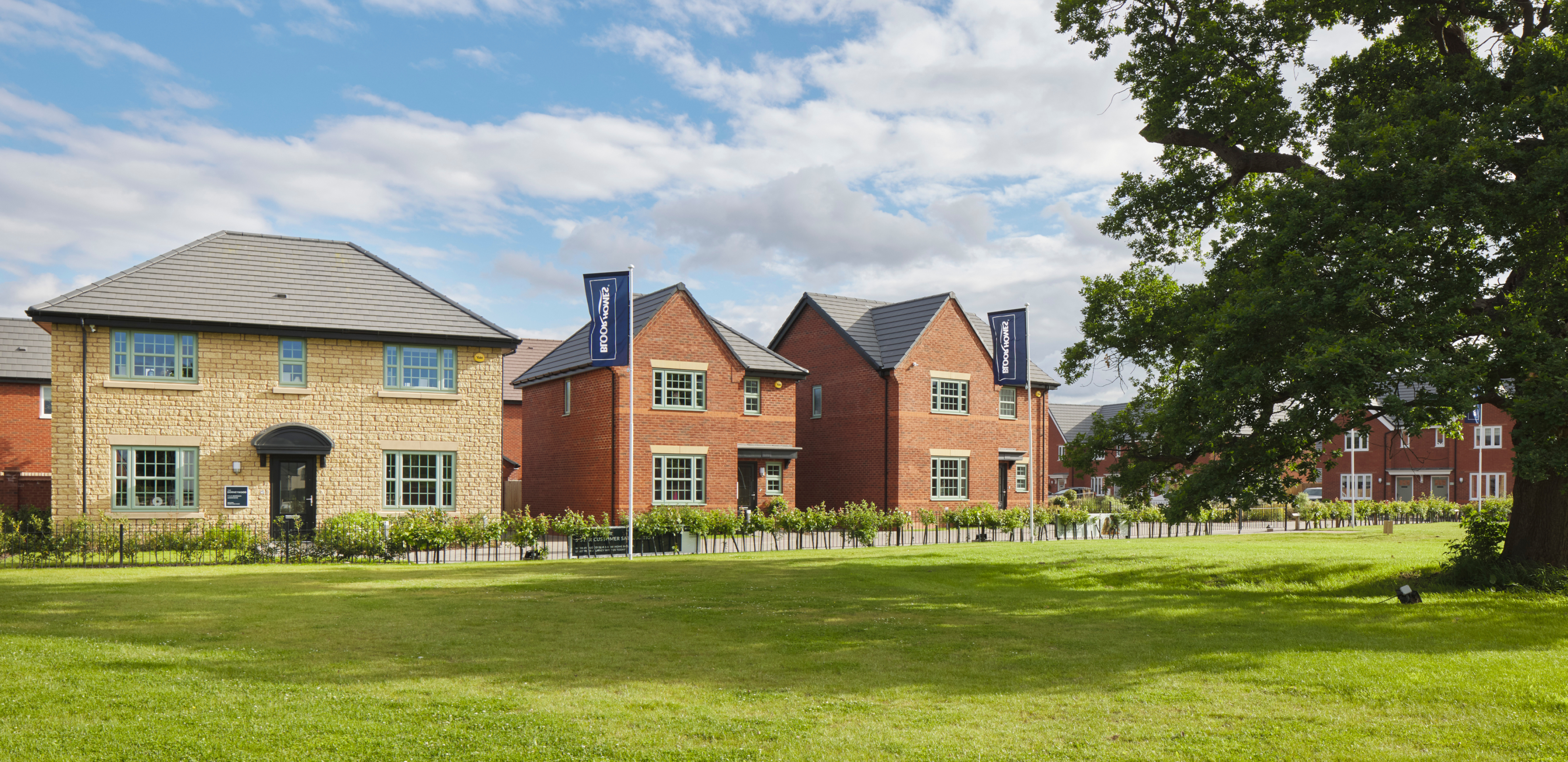
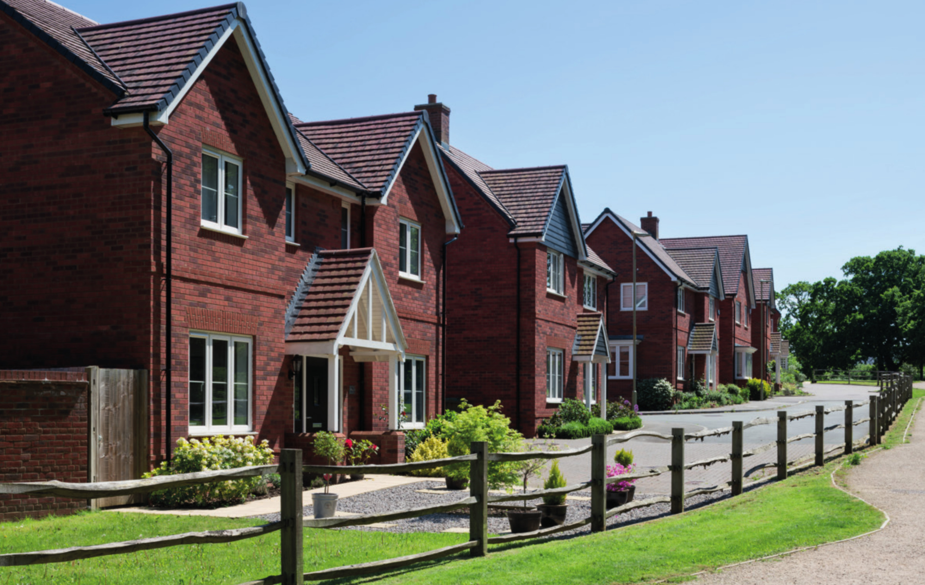
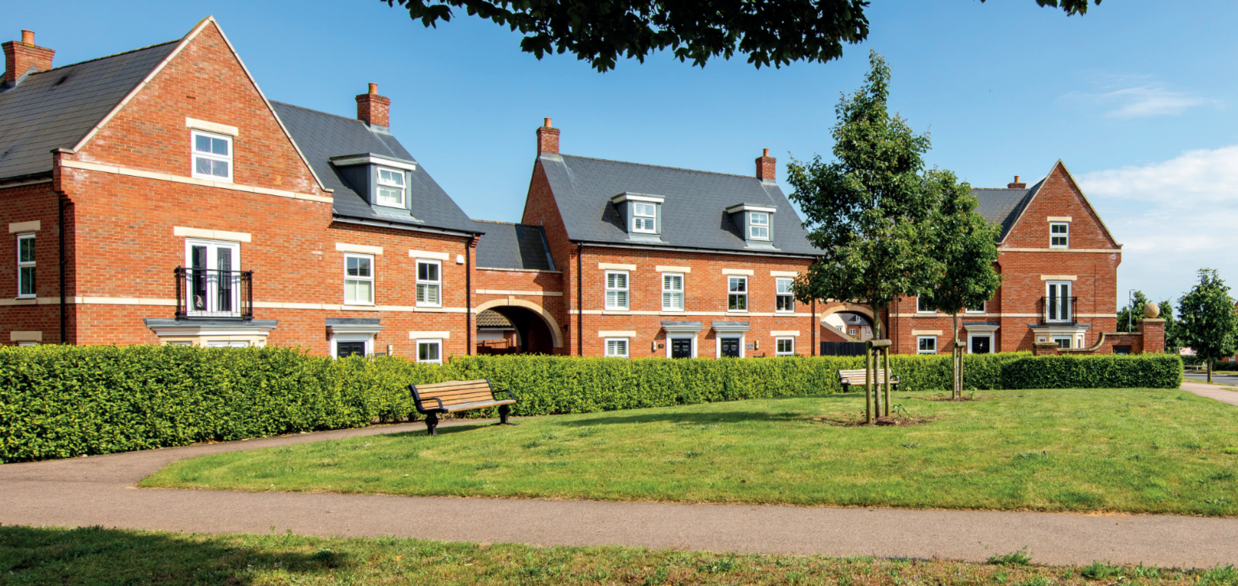
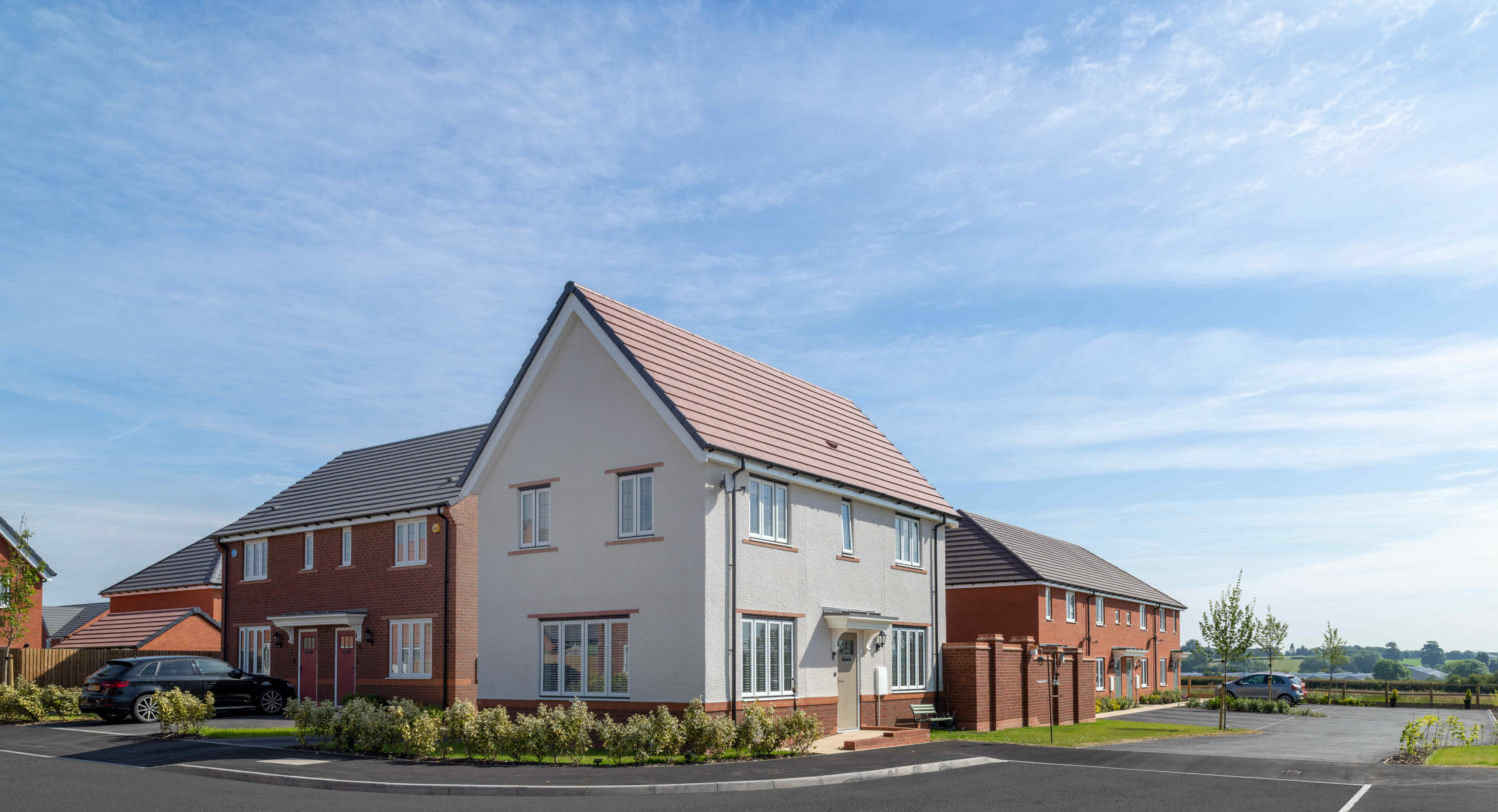
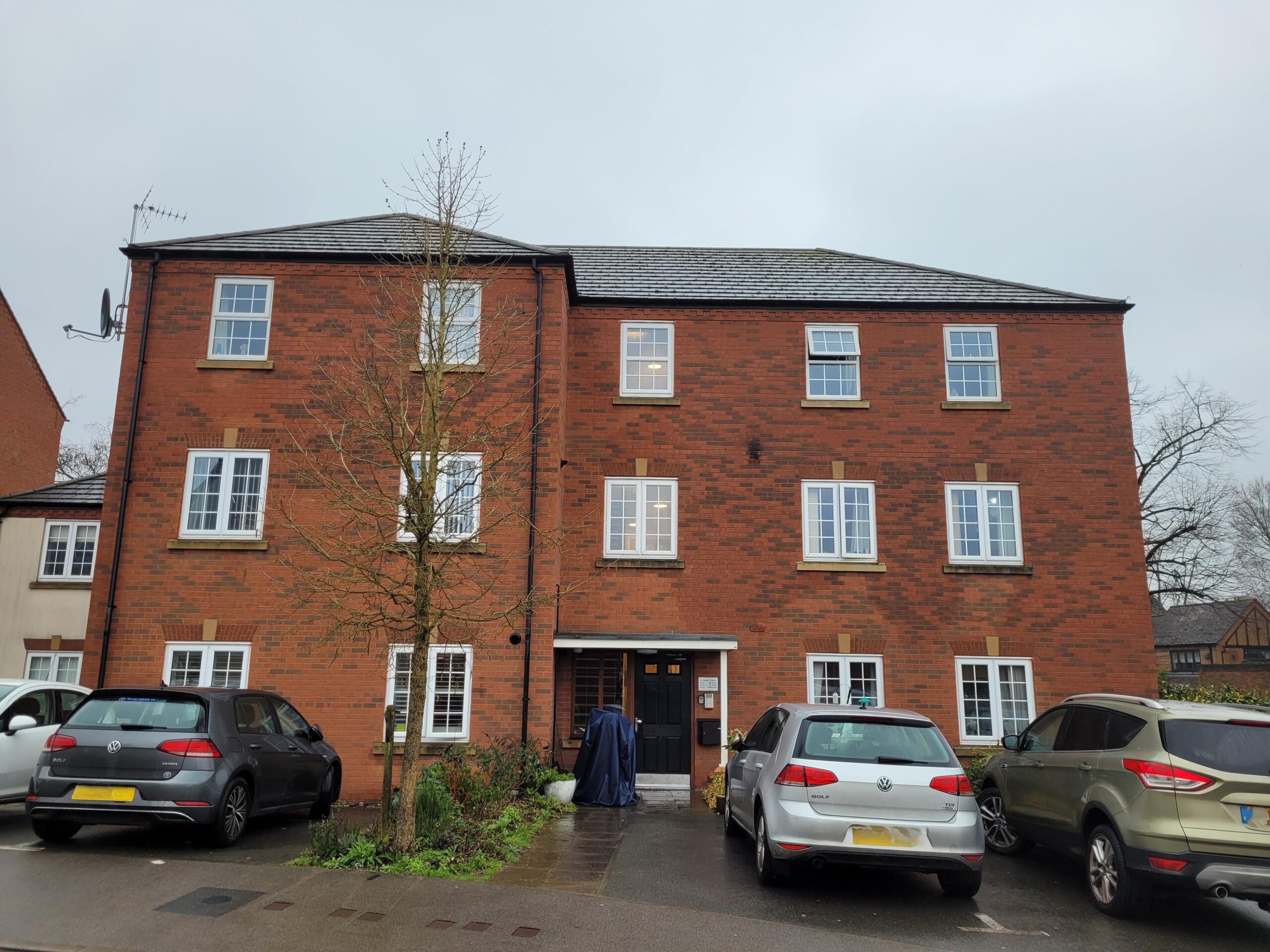
While house types would be determined at the reserved matters planning stage, we have provided imagery of existing Bloor Homes developments on this website to provide an idea of the types of high-quality homes they build. Click on the adjacent image to open a gallery of examples of existing Bloor Homes developments.
Bloor Homes also builds bungalows, and there is scope to do so at Coleshill if there is local demand.
Use the feedback questionnaire to tell us the types of homes you would like to see prioritised in Coleshill.

Examples of some recent Bloor Homes developments. Click to open a gallery of images.
Affordable homes
As the site is being proposed for development as a Grey Belt site, up to 50% of the new homes would be classified as affordable homes in line with national policy. This will provide opportunities for those on lower incomes with connections to the local area to secure a home of their own. Affordable housing is anticipated to be provided in a mix of affordable rent and shared ownership homes which would appeal to first time buyers. However, the precise mix will be determined in consultation with North Warwickshire Borough Council’s Housing Team.
We are happy to work with North Warwickshire Borough Council for them to apply Local Occupancy Criteria to the affordable housing provision, if this is a priority in community feedback. This would see affordable housing prioritised for those with a local connection.

Up to 50% of the new homes will be provided as affordable homes, including shared ownership homes that would appeal to first-time buyers
Sustainable homes
At Bloor Homes we want to deliver homes that are sustainable now and contribute to a cleaner, greener future.
We know that sustainability is hugely important to communities across the country. It is anticipated that the new homes at Coleshill would be built to be Net Zero Carbon-ready.
The neighbourhood will be gas-free, with all homes provided with air source heat pumps as standard. Solar panels will also be incorporated, which along with the use of the latest materials and technique to maximise insulation, air tightness and heat recovery, will create an uplift in energy efficiency of 75-80%.
The new homes will incorporate sanitaryware and appliances that meet the highest water efficiency standards.
Electric vehicle (EV) charging points will be provided for all homes with on plot parking, together with access to communal EV charging points for the whole neighbourhood.
To minimise the impact of construction, we always aim to procure materials from sustainable sources and recycle construction waste as far as is possible.

The new homes for Coleshill will incorporate a range of sustainability measures, including EV charging, air source heat pumps, solar panels and uprated insulation.
The new homes at Coleshill would be built to Net Zero Carbon standards, incorporating solar panels, air source heat pumps and uprated insulation. They would become operationally Net Zero Carbon once the electricity grid supply has switched to 100% renewable and zero carbon sources.
Care village
Father Hudson's Caritas are a local social care charity who have been part of the Coleshill community for nearly 125 years. As part of the proposed site, they are proposing to develop further residential and supported living provision for adults with disabilities and others needing social care. Father Hudson's Caritas’ existing care facilities include St Catherine's Bungalows, St Joseph's Care Home, Coleshill Day Services and St Vincents Supported Living facilities. These are already an established part of the local community.
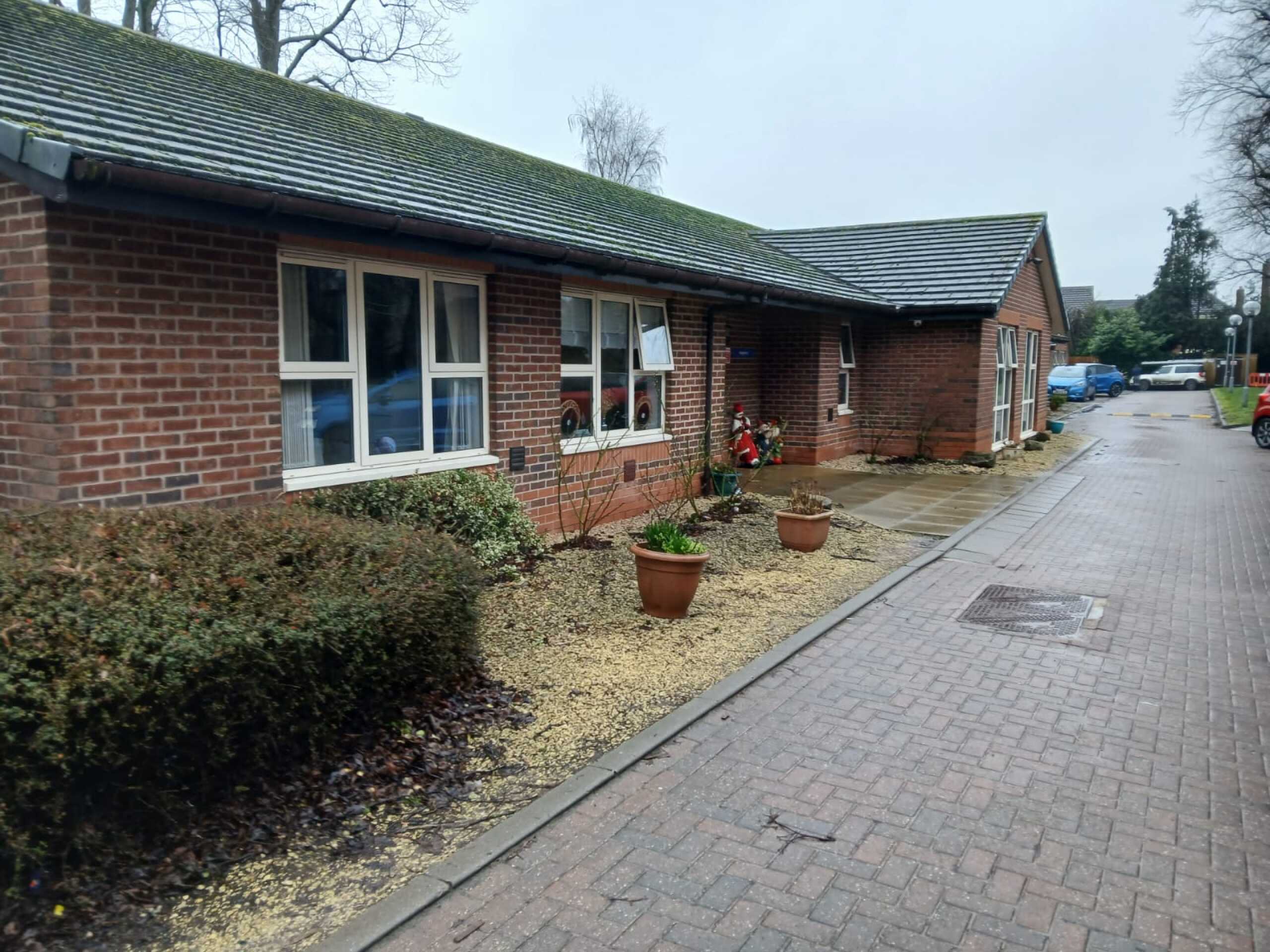
St Catherine’s Bungalows - an example of an existing Father Hudson's Caritas care facility in Coleshill
St Vincents Supported Living – an example of an existing Father Hudson’s Caritas care facility in Coleshill.
Investing in local infrastructure
A key consideration with a planning proposal such as this is to ensure that local services receive the investment they need to accommodate housing growth. The development will generate investment into local infrastructure such as healthcare and education, and this will be informed by consultation carried out by North Warwickshire Borough Council with statutory bodies such as the local NHS Integrated Care Board, local education teams and highways authority, and will be secured via legal agreement between Bloor Homes and the Council. This is a requirement for Grey Belt proposals, and the scheme would not be approved unless it has been evidenced that such agreement on infrastructure contributions has been achieved.
Use the feedback questionnaire to let us know your priorities for infrastructure investment in Coleshill and the surrounding area.

Access and highways
Primary vehicular access will be provided from Maxstoke Lane to the north via a simple priority junction, in addition to a connecting pedestrian footway which will provide access to the local facilities and amenities in the centre of Coleshill. The design of the junction including the necessary visibility splays is being informed by recent traffic survey data that has recorded speeds and volumes of passing vehicles.
A secondary access for pedestrians and cyclists will be provided from Gerards Way, which will also provide access for emergency vehicles should it be required. Gerards Way is a quieter lower speed environment and provides a more direct access for future residents to the secondary school as well as providing an alternative route to the primary school via active travel means. There will be no through route for traffic between Maxstoke Lane and Gerards Way.
In terms of wider connectivity, the site is in a highly sustainable location, being immediately adjacent to the existing settlement boundary of Coleshill. The town centre and its shops are around 600m north of the site and a large food supermarket is 750m from the northern boundary of the site. Coleshill Primary School is c750m from the centre of the site and Woodlands Primary School and Coleshill Secondary School are 1km to the south. There are existing bus stops located close to the site along Coventry Road served by the X13 which provides a half hourly service between Chelmsley Wood and Birmingham City Centre. Coleshill Parkway Station is c2.5km from the centre of the site which is a reasonable cycling distance and at the upper limit of the distance people could be expected to walk. This provides access to Birmingham, Leicester and Stanstead Airport. The large employment area around Gorsey Lane and Roman Way is also accessible by walking and cycling from the site.
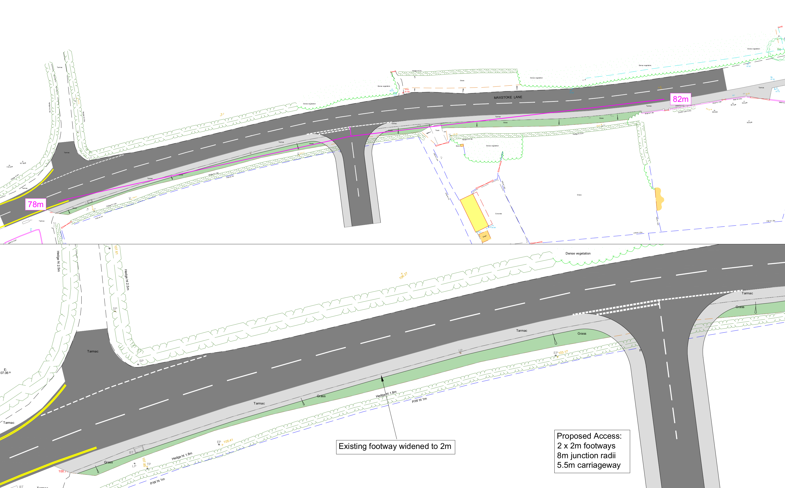
Early technical drawings of how the junction at Maxstoke Lane could be designed. Technical studies are ongoing to inform the final design
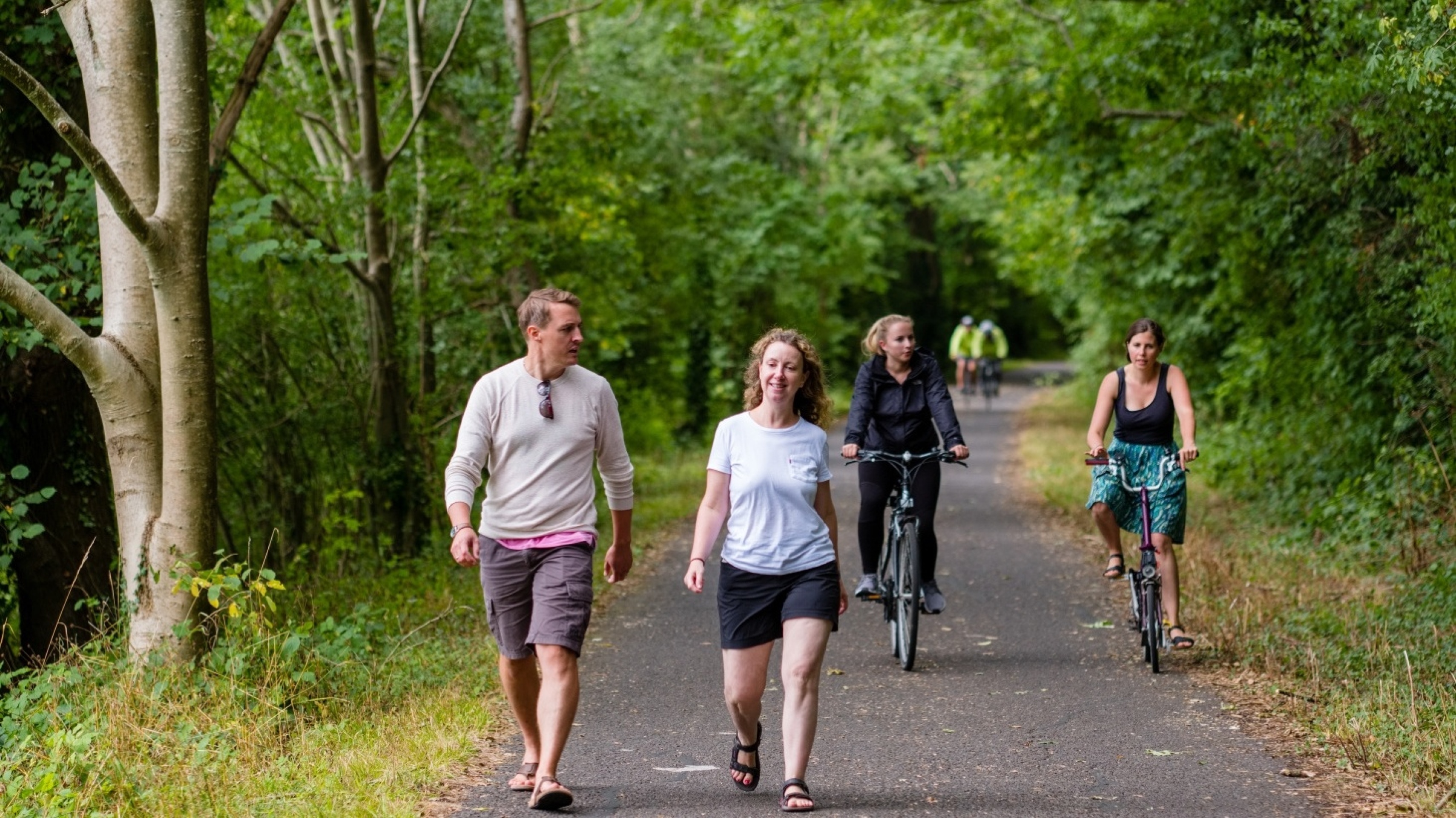
The development will provide a network of new walking and cycling routes, with opportunities for onward links to existing routes in the wider area
Green infrastructure
At Bloor Homes, we want to ensure that natural habitats are protected while we deliver new homes for people and families.
We are conscious of the ever-increasing importance of ensuring that development is sustainable, protecting and enhancing natural habitats and green infrastructure as much as possible whilst delivering much needed homes for people and families.
The provision of high-quality green public open spaces is at the heart of the landscape-led approach to sensitive development at Coleshill, with around 60% of the overall site area being retained as open space. Existing mature trees and the vast majority of hedgerows will be retained. Alongside this, extensive additional planting of new trees and vegetation will enhance habitat provision across the site and increase tree cover.
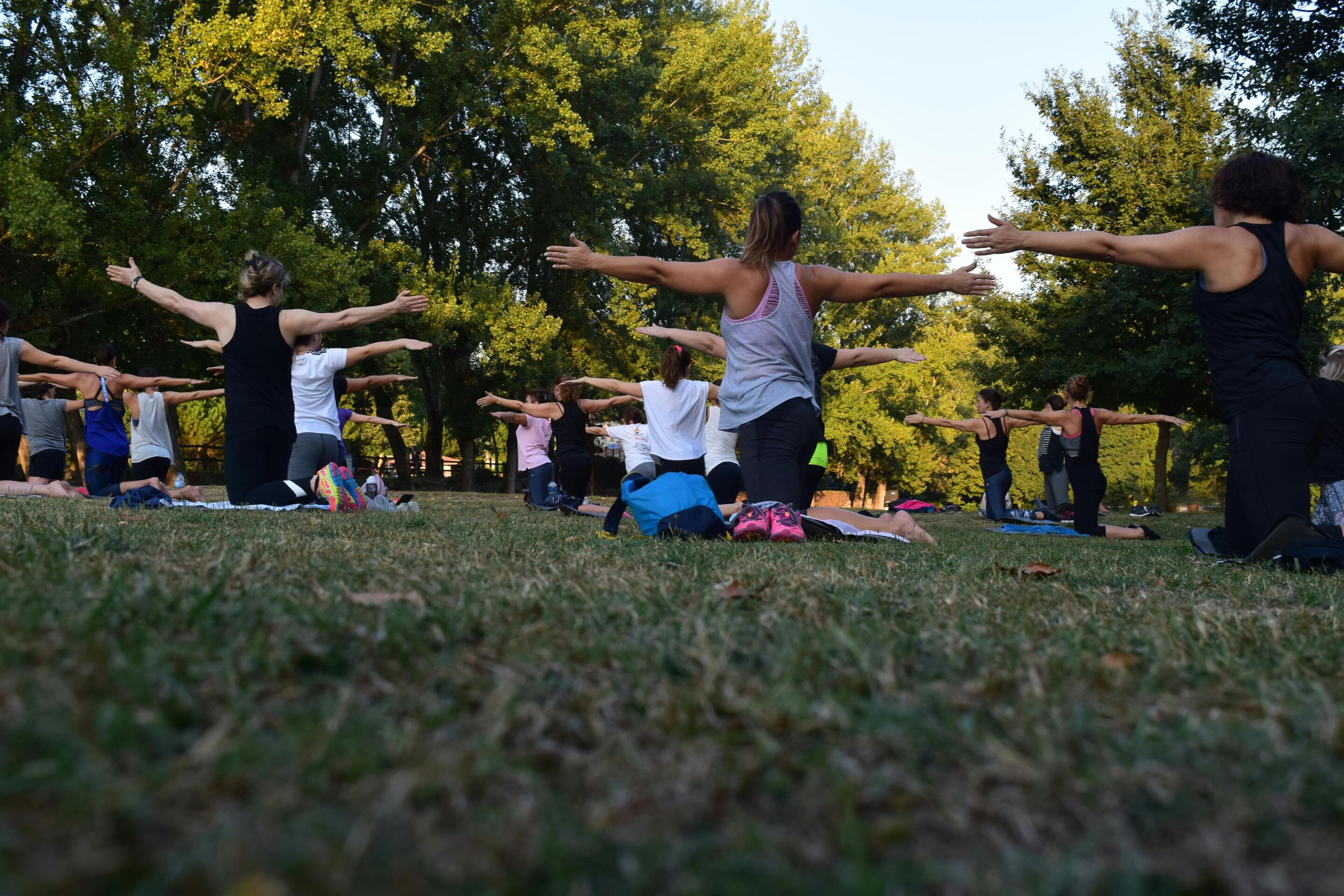
The development will feature high quality open spaces providing a range of outdoor recreational opportunities.
Public open space and country park
The new neighbourhood will feature extensive green public open spaces, including a large area of country parkland in the northeastern section of the site. This will provide a new outdoor recreational resource for Coleshill, providing opportunities for people to connect with nature, with extensive areas of biodiversity enhancement and planting.
A network of walking and cycling routes linking with existing public rights of way will be set within the extensive landscaped open spaces, as well as features including children’s play areas for new and existing residents and areas for natural play.
The proposals will see around 60% of the overall site area provided as open space, including an area of country parkland in the northeastern section of the site.
Ecology and biodiversity net gain
A Preliminary Ecological Appraisal has been prepared which outlines baseline ecological features present on-site and identifies the ecological opportunities and constraints associated with the proposed development.
The site comprises grassland and arable fields all enclosed by native hedgerows, several of which are associated with mature trees and ditches. Additionally, the site features small areas of scrub, standing deadwood and a pond.
The arable habitat is considered to have limited ecological value whilst the grassland fields hold greater ecological interest, though this habitat is considered to be common and widespread in the local landscape. Site features such as the pond, mature trees and native hedgerow network provide higher value habitat opportunities for wildlife and offer connectivity to off-site habitats in the wider area. These higher value habitats will be retained and enhanced as much as possible.
Surveys of on-site habitats and protected species surveys for bats, badger, otter, reptiles and amphibians have been completed. Bat surveys have recorded largely common and widespread species utilising the site boundaries, with lower instances of rarer species. Results of the surveys have found otter, reptiles and great crested newt to be likely absent. Survey results will be used to inform an Ecological Impact Assessment to identify predicted ecological impacts and set out the necessary impact avoidance and mitigation measures, where necessary.
A Biodiversity Net Gain assessment will be prepared to support the scheme and identify the net change in biodiversity that will occur. Early considerations have been made to ensure that the proposals maximise opportunities to enhance biodiversity alongside the development, including the provision of new wildflower meadow as well as hedgerow, thicket and tree planting throughout the scheme.

Homes for Nature
Bloor Homes is proud to be a member of the Homes for Nature programme. This will see the installation of nesting bricks/boxes in every new home and hedgehog highways between gardens.
Drainage
Environment Agency Flood Maps show that the site is located within Flood Zone 1 and is therefore at low risk of flooding from rivers and the sea. Areas shown to be at risk of surface water flooding are located outside of the proposed development area and are associated with existing low-lying land and watercourses. These areas will not be affected by the proposed development.
The development will include a new, surface water drainage system designed to manage rainfall in a controlled and sustainable way. This system will collect surface water from the development and direct it to a series of detention basins, which temporarily store water during heavy rainfall before releasing it slowly. This approach ensures that runoff from the site is carefully controlled and that there is no increase in flood risk to neighbouring land. Surface water from the development will be discharged at restricted rates to the existing watercourse network located in the lower area of the site, in line with current drainage standards. The proposed drainage strategy will ensure that water is managed safely on-site during extreme rainfall events.
In addition to managing surface water drainage, the sustainable drainage features such as the detention basins have the added benefit of providing new more varied wetland habitats with appropriate wetland planting, further enhancing biodiversity within the site.
The sustainable drainage system for the new neighbourhood will also provide biodiversity benefits through the provision of wetland habitat.
Foul Water Drainage
Foul water from the development will be collected through a new drainage network and conveyed to the existing public sewer system. Due to the natural shape and levels of the site, a new pumping station will be provided to allow foul water to be conveyed to the wider sewer network, subject to agreement with the local water authority.
Landscape
The site comprises mainly of small scale pastoral fields and a single larger field to the north east (currently laid to grass). The fields within the Site are typically sub-divided by established field hedgerows. There are a number of hedgerow trees located within the field boundaries to the north of the site, with a greater presence of trees within the field boundaries to the south. As set out above, the design proposals will seek to retain existing trees and the vast majority of hedgerows whereever possible, alongside extensive new landscape planting.
To the immediate west of the site is the urban area of Coleshill, which occupies a slightly elevated location within the surrounding landscape along the route of Coventry Road. The western edge of Coleshill is bound by the route of the A446, with the M42 and M6 road corridors beyond and wrapping around the southern edge of the settlement.
The site is not covered by any statutory or non statutory designations for landscape character or value. Public Footpath 155/M65 crosses the northern part of the Site and continues east to Maxstoke Lane.
The site is identified in the North Warwickshire Landscape Character Assessment (2009) within Landscape Character Area (LCA): 8, Blythe Valley Parkland Farmland. This includes land extending east and south from the southern edge of Coleshill and contains the valley of the River Blythe.
A Landscape and Visual Impact Assessment (LVIA) will be undertaken to inform the design of the Proposed Development and accompany the planning application.
Heritage and Archaeology
Archaeology
A desk-based assessment and geophysical survey have been carried out to help clarify the archaeological significance and potential of the site. As part of this assessment, the Warwickshire Historic Environment Record has been consulted.
Coleshill was recorded as ‘Colleshyl’ in 799, possibly meaning ‘hill on the River Cole’. The site of this Anglo-Saxon settlement at Coleshill is thought to have been located on a prominent hill on the River Cole, near its confluence with the Blythe and Tame c.340m north of the site, where the Church of St Peter and St Paul is located now, and where a pre-conquest minster church is believed to have been located. This also formed the focus for Medieval settlement.
Coleshill was then recorded as ‘Coleshelle’ in 1086 and was a settlement in the Domesday book, located in the hundred of Coleshill in the county of Warwickshire. It had a recorded population of 54 households in 1086, putting it in the largest 20% of settlements recorded at the time. The land belonged to King William, with the Lord in 1066 recorded as King Edward.
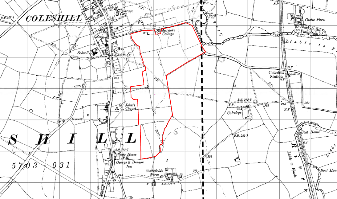
Later 18th century mapping depicts a settlement at Coleshill along the High Street. The more detailed 19th century mapping shows the site located within agricultural land. By the mid-20th century parts of the site are shown to have been terraced and used for a sports track with a pavilion and swimming pool. The terracing can still be seen although the sports track, pavilion and swimming pool are no longer in place.
Geophysical survey did not identify any anomalies of definite archaeological interest. There are some anomalies which might represent agricultural remains in the form of ridge and furrow and there are also features likely to represent former field boundaries. Modern disturbance was recorded across the central and southern parts of the site.
The site is considered to be ‘quiet’ in archaeological terms; further archaeological investigation, in the form of evaluation trial-trenching, will be undertaken as part of the planning process and the scope of this work will be agreed with North Warwickshire Borough Council’s archaeological advisor.
A selection of historic maps showing the site in its historic context in 1760, 1904-05, 1955 and 2006.
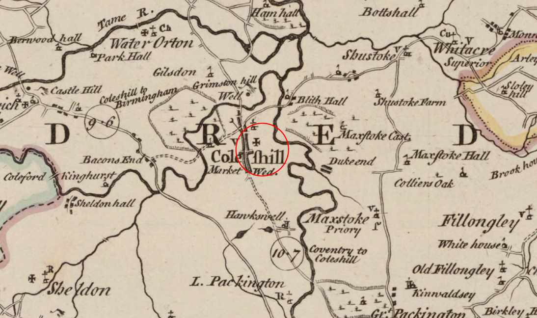
1760
1904-05
1955
2006
Built Heritage
An assessment of the potential impact of proposed development on built heritage assets in the vicinity of the site has been carried out. There are no designated or non-designated heritage assets within the site. The assessment has highlighted that development would potentially have an effect on the significance of the Grade I listed Church of St Peter and St Paul; the Grade II listed Roman Catholic Church of the Sacred Heart and St Teresa; the Coventry Road, Coleshill Conservation Area; and the Coleshill (North Warwickshire) Conservation Area. This would arise from a visual change in landscape character within the wider setting of these assets. Ultimately, key views of and within these assets would remain unaffected within their designations and/or more immediate setting; the scale of the proposed development would not be visually obtrusive to their appreciation, ensuring any potential less than substantial harm arising from the proposed development would be in the lower ranges. The assessment has demonstrated that the proposed development would not bear an impact on the significance of the Grade II* listed Church of St Cuthbert, the non-designated Maxstoke Cottage or any of the non-designated historic structures at Southfields Farm.
These potential effects have been taken into consideration when masterplanning the site and careful design has ensured that views from within the site of the upper elements of the Grade I listed Church of St Peter and St Paul and the Grade II listed Roman Catholic Church of the Sacred Heart and St Teresa will remain accessible and that any potential effects are kept to the lowest level possible.
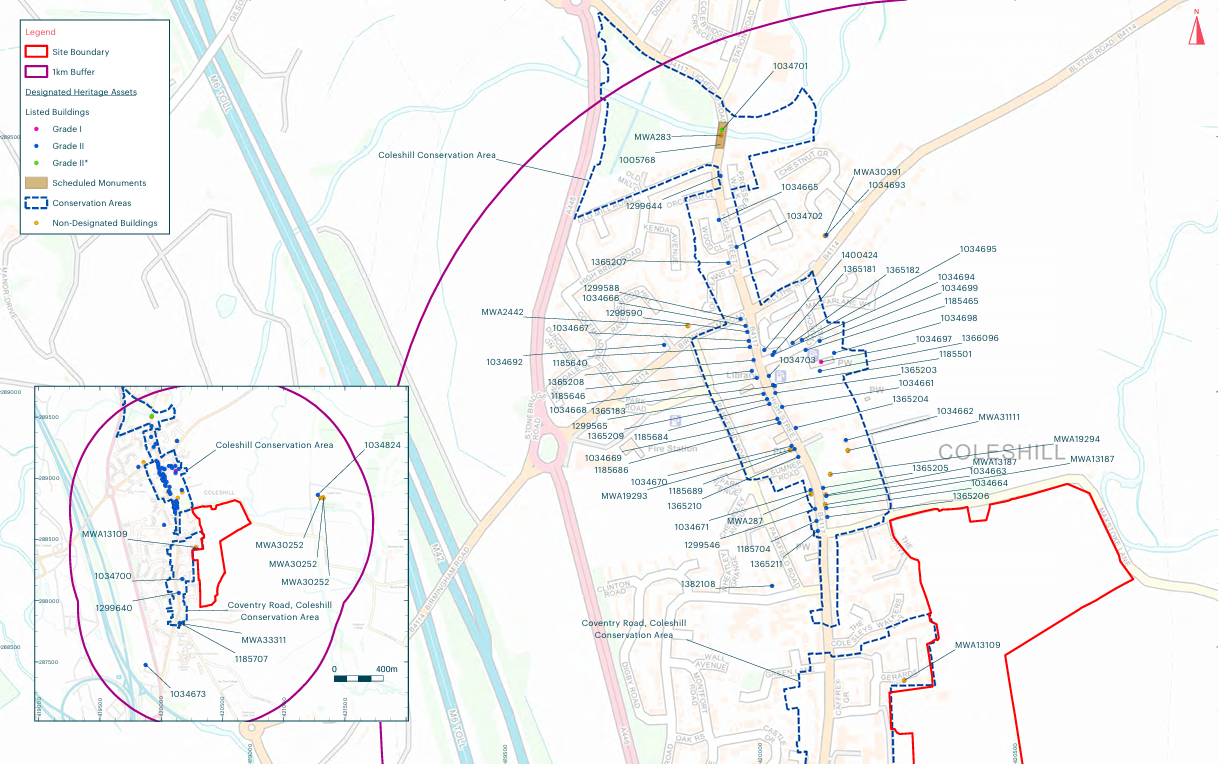
A plan showing the site in relation to nearby heritage assets which have been carefully assessed in the emerging design to ensure that any potential impacts are kept to a minimum
Other technical considerations
In preparing an outline planning application for the proposed development, a full suite of technical studies is being completed, covering matters such as Highways, Flooding and Drainage, Ecology, Noise, Heritage, Contamination etc. It is not anticipated that there will be any significant technical constraints to delivering a high quality, sustainable new neighbourhood at this site.
Your feedback
Once you have had an opportunity to review the information above, and view the illustrative masterplan on the interactive map, please take a moment to complete our short feedback questionnaire. Please ensure all feedback is submitted by midnight on Wednesday 11th March 2026 to ensure that it can be taken into account as an outline planning application is prepared.